
Brief description
This data set consists of .tif files of true colour orthomosaics for expansive areas of mangroves in Kakadu National Park in Australia's Northern Territory.
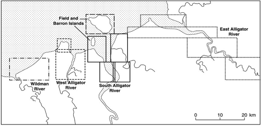
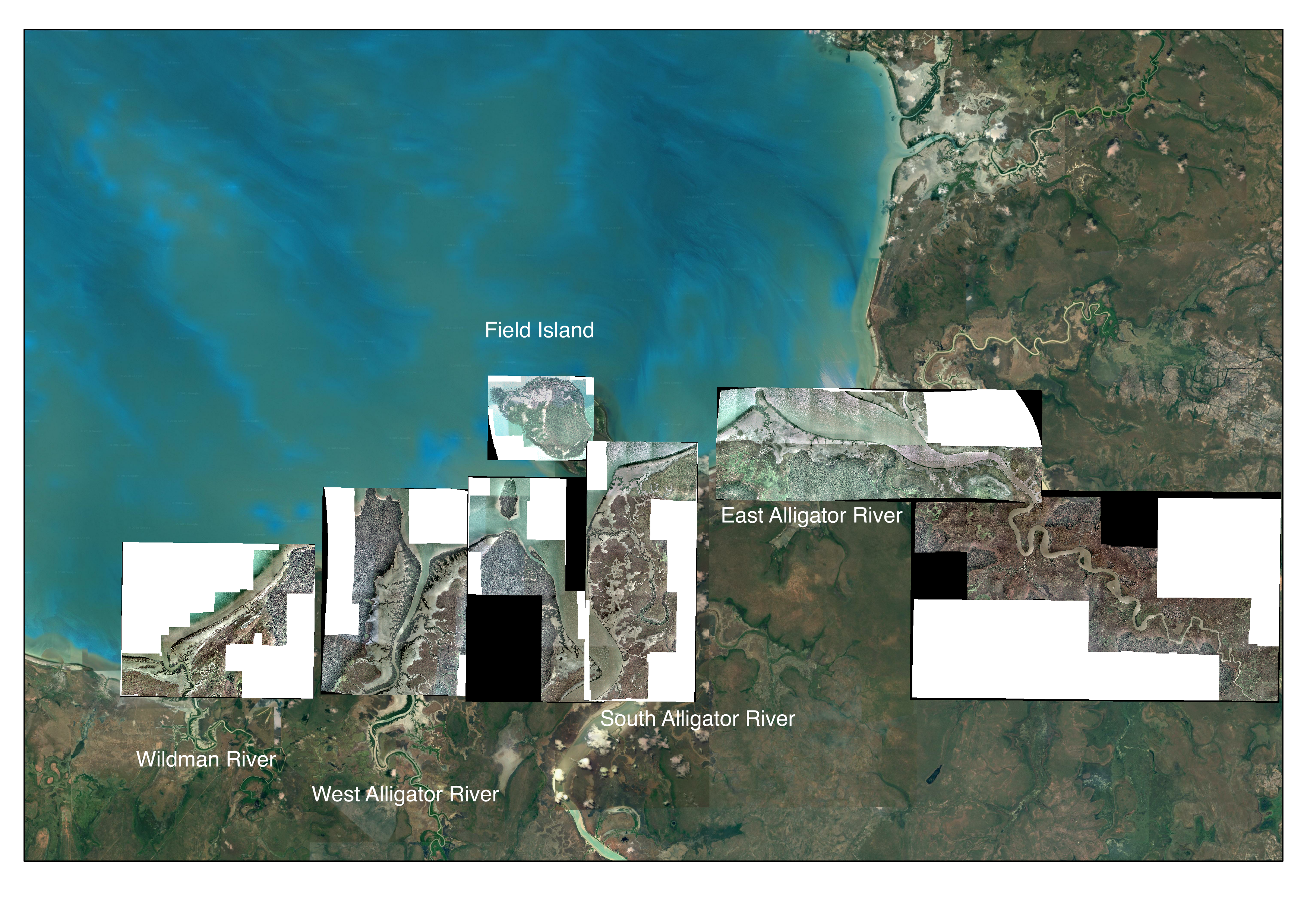
The orthomosaics were generated from 68 stereo pairs of true colour aerial photographs acquired in 1991 in the lower reaches of the East Alligator, West Alligator, South Alligator and Wildman Rivers and Field Island, Kakadu National Park, Northern Australia (Mitchell et al., 2007). The photographs were taken at a flying height of 13,000 ft (3,960 m) using a Wild CR10, a standard photogrammetric camera with a frame size of 230 x 230 mm. The focal length was 152 mm. The photographs were scanned by Airesearch (Darwin) with a photogrammetric scanner to generate digital images with a pixel resolution between 12 and 15 mm. The orthomosaics have a spatial resolution of 1 m, cover an area of approximately 742 km2 and a coastal distance of 86 km.
These orthomosaics were co-registered using ground control points identified from 1:100,000 digital topographic maps with a Universal Transverse Mercator (UTM), and subsequently co-registered to LiDAR data acquired over the same region in 2011.
Lineage
Data Creation
Overview:
Digitizing points from 1:100 000 scale maps implied an accuracy of 0.5 mm on the map and hence 50 m on the ground. Based on the topographic map scale, the horizontal and vertical (absolute) accuracies of the ground control points (GCPs) were estimated at 50 m and 2 m respectively. The overall integrity of the registration was high as numerous tie points were located in the overlapping regions to assist in stabilizing adjoining images.
Methods:
Following collection of GCPs, the Kakadu National Park (KNP) photographs were orientated using standard collinearity equations (Jones, 1982) and resampled to 0.37 m spatial resolution. The output from the transformation gave residuals (root mean square errors; RMSE) to all point measurements in image coordinates. These residuals were checked and, where necessary, new points were taken or existing ones were relocated until the residuals were less than one pixel, thus ensuring that the relative positioning within the block was of the order of one pixel (or 0.37 m) on the ground. The residuals on the GCPs were checked to ensure that they were within the predicted horizontal (i.e. 50 m) and vertical accuracy (i.e. 2 m).
Notes
CreditWe at TERN acknowledge the Traditional Owners and Custodians throughout Australia, New Zealand and all nations. We honour their profound connections to land, water, biodiversity and culture and pay our respects to their Elders past, present and emerging.
Orthomosaic maps can help in a number of ways by providing a detailed, accurate map of the conditions in a given area.
Data Quality Assessment Result
local :
Quality Result
Accordingly, the absolute accuracy of the position of any object point on the orthophoto-image was of the order of 50 m. The accuracy of the scale of the orthophoto-image was higher as this depends upon the distance between GCPs; the greater this distance, the more accurate the scale. Hence, relative measurements between points on the orthophoto-image were more accurate than the absolute accuracy of their positions. The mosaics (with the exception of the East Alligator orthomosaics) were registered subsequently to LiDAR acquired in 2011 by Asbridge and Lucas (2016), with this producing a positional error of < 5 m and typically < 2 m. The mosaics registered to the 2011 LiDAR data are provided through this portal. The East Alligator River mosaic (not registered to the LiDAR data) is also provided for completeness.
Created: 2022-02-01
Issued: 2022-02-24
Modified: 2026-03-02
Data time period: 1991-05-01 to 1991-05-01
text: Mangroves within the lower reaches of the East Alligator, West Alligator, South Alligator, Wildman Rivers and Field Island, Kakadu National Park, Northern Australia
User Contributed Tags
Login to tag this record with meaningful keywords to make it easier to discover
- URI : geonetwork.tern.org.au/geonetwork/srv/eng/catalog.search#/metadata/35b183bc-f5f8-4bdd-8607-af425042f49e

- global : 35b183bc-f5f8-4bdd-8607-af425042f49e
